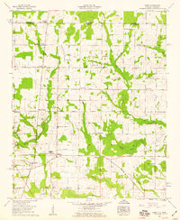
1958 Map of Toney
USGS Topo · Published 1959About this map
Madison Crossroads and Toney anchor this late 1950s survey of the rural borderlands between Madison Co and Lincoln Co. The landscape is defined by the headwaters of Limestone Creek and Brier Fork Flint River, where numerous family-named cemeteries such as Golightly Cem and Taylor Cem sit alongside established community hubs like Friendship State Line Church and Bethlehem Church. A notable piece of local history is visible in the southwest, where an Old Railroad Bed runs parallel to the modern highway through Toney, tracing an earlier era of transport before the reliance on roads like Pulaski Pike. The map illustrates a transitional period of agricultural land use, punctuated by small schoolhouses like New Sharon Sch and Toney Sch that served these distributed farming communities just south of the Tennessee-Alabama state line.
Find a feature on this map
47 named features on this map. Tap any name to fly to it.
Don’t see what you’re looking for? This feature index may not catch every label — zoom into the map to look around manually.
Map Details
Editions of this 1958 Toney Map
3 editions found
Other maps of this area

1888 · Huntsville
USGS Topo · 1:125,000

1892 · Huntsville
USGS Topo · 1:125,000

1936 · Jeff
USGS Topo · 1:24,000

1936 · Capshaw
USGS Topo · 1:24,000

1936 · Taft
USGS Topo · 1:24,000

1936 · Meridianville
USGS Topo · 1:24,000

1936 · Fisk
USGS Topo · 1:24,000

1936 · Ardmore
USGS Topo · 1:24,000

1936 · Lincoln
USGS Topo · 1:24,000

1936 · Toney
USGS Topo · 1:24,000