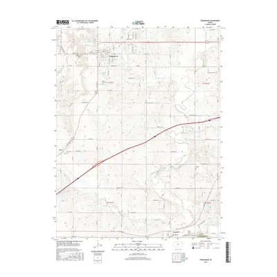
2016 Map of Tonganoxie
USGS Topo · Published 2016About this map
Tonganoxie anchor the northern portion of this landscape, where the confluence of several small watercourses like Tonganoxie Cr and Cow Cr define the local topography. Further south, the terrain descends toward the broad valley of Stranger Creek, a significant hydrological feature that winds past Linwood near the southern boundary. This area in Leavenworth County is notable for its high density of rural burial grounds, which offer significant value for genealogical research.
Find a feature on this map
82 named features on this map. Tap any name to fly to it.
Don’t see what you’re looking for? This feature index may not catch every label — zoom into the map to look around manually.
Map Details
Editions of this 2016 Tonganoxie Map
This is the sole edition of this map. No revisions or reprints were ever made.
Other maps of this area

1885 · Lawrence
USGS Topo · 1:125,000

1886 · Oskaloosa
USGS Topo · 1:125,000

1887 · Olathe
USGS Topo · 1:125,000

1888 · Oskaloosa
USGS Topo · 1:125,000

1889 · Lawrence
USGS Topo · 1:125,000

1890 · Kansas City
USGS Topo · 1:125,000

1893 · Olathe
USGS Topo · 1:125,000

1894 · Kansas City
USGS Topo · 1:125,000

1894 · Oskaloosa
USGS Topo · 1:125,000

1934 · Bonner Springs
USGS Topo · 1:48,000