
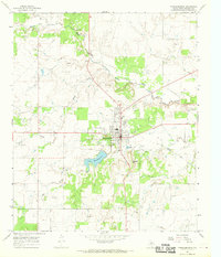
1966 Map of Tonk Creek
USGS Topo · Published 1969About this map
The Throckmorton County ranchlands of north-central Texas are defined here by a dense network of seasonal watercourses and prominent local topography. Sellers Hill rises as a significant landmark above the surrounding plains, overlooking the confluence of the West Fork and East Fork as they feed into Tonk Creek. This 1966 field-checked survey illustrates a landscape primarily shaped by its drainage patterns, with Tecumseh Creek and Horse Creek carving intricate relief through the limestone-underlaid terrain. While the area remains largely rural and open, the map records industrial activity through numerous Gravel Pits and various Drill Holes, alongside a major utility corridor marked simply as Pipeline. These markers provide essential evidence of mid-century land use and resource extraction in this portion of the Texas Rolling Plains.
Find a feature on this map
17 named features on this map. Tap any name to fly to it.
Don’t see what you’re looking for? This feature index may not catch every label — zoom into the map to look around manually.
Map Details
Editions of this 1966 Tonk Creek Map
2 editions found
Other maps of this area

1954 · Wichita Falls
USGS Topo · 1:250,000

1958 · Wichita Falls
USGS Topo · 1:250,000

1962 · Antelope Creek SW
USGS Topo · 1:24,000

1962 · Antelope Creek SE
USGS Topo · 1:24,000

1965 · Reynolds Bend NW
USGS Topo · 1:24,000
1966 · Hoover Mountain
USGS Topo · 1:24,000

1966 · Westover SW
USGS Topo · 1:24,000
1966 · Reynolds Bend
USGS Topo · 1:24,000
1966 · Sibley Creek
USGS Topo · 1:24,000
1966 · Throckmorton
USGS Topo · 1:24,000