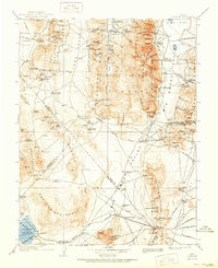
1908 Map of Tonopah
USGS Topo · Published 1951About this map
Smoky Valley and the surrounding high desert of central Nevada reveal a landscape shaped by early 20th-century mining booms and remote ranching outposts. This era of extraction is visible through numerous workings like the Liberty Mine and the Sullivan Mine, while the Goldfield and Tonopah RR provided the critical heavy transport link for the region's mineral wealth. The map documents early-century settlements such as Round Mountain, Manhattan, and Berlin, many of which were tied directly to the nearby ore deposits.
Find a feature on this map
144 named features on this map. Tap any name to fly to it.
Don’t see what you’re looking for? This feature index may not catch every label — zoom into the map to look around manually.
Map Details
Editions of this 1908 Tonopah Map
3 editions found
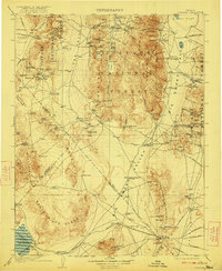
Other maps of this area

1898 · Silver Peak
USGS Topo · 1:125,000

1900 · Silver Peak
USGS Topo · 1:125,000

1907 · Tonopah
USGS Topo · 1:250,000

1908 · Kawich
USGS Topo · 1:250,000

1908 · Lida
USGS Topo · 1:250,000

1908 · Tonopah
USGS Topo · 1:250,000

1908 · Carson Sink
USGS Topo · 1:250,000

1909 · Hawthorne
USGS Topo · 1:250,000

1910 · Carson Sink
USGS Topo · 1:250,000

1911 · Hawthorne
USGS Topo · 1:250,000