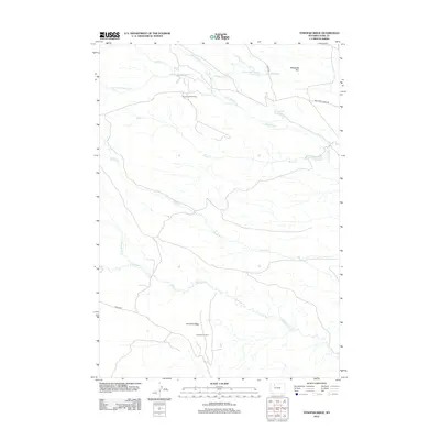
2012 Map of Tonopah Ridge
USGS Topo · Published 2012About this map
The Pitchfork Oil Field and Spring Creek Oil Field anchor the southern and northern sectors of this Wyoming landscape, illustrating the critical role of energy extraction in Park County. The terrain is defined by the prominent Tonopah Ridge and the Meeteetse Rim, which overlook a complex network of waterways and irrigation infrastructure. Engineered water management is evident through the Joe Moss Ditch and Long Hollow Ditch, which divert water from Meeteetse Cr and Horse Cr to support the arid environment. Several reservoirs, including Horse Creek Number 1 Reservoir and Rush Creek Reservoir, provide essential water storage in a region dominated by seasonal creek beds like Rawhide Cr and Rush Cr. The map's detail provides a clear view of the industrial and topographical layout of this sparsely populated ranching and oil-producing corridor.
Find a feature on this map
20 named features on this map. Tap any name to fly to it.
Don’t see what you’re looking for? This feature index may not catch every label — zoom into the map to look around manually.
Map Details
Editions of this 2012 Tonopah Ridge Map
This is the sole edition of this map. No revisions or reprints were ever made.
Other maps of this area

1911 · Meeteetse
USGS Topo · 1:62,500

1911 · Oregon Basin
USGS Topo · 1:62,500

1913 · Oregon Basin
USGS Topo · 1:62,500

1913 · Meeteetse
USGS Topo · 1:62,500

1955 · Cody
USGS Topo · 1:250,000

1957 · Devils Tooth
USGS Topo · 1:62,500

1957 · Sunshine Reservoir
USGS Topo · 1:62,500

1958 · Cody
USGS Topo · 1:250,000

1962 · Cody
USGS Topo · 1:250,000

1980 · Carter Mountain
USGS Topo · 1:100,000