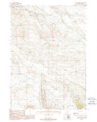
1988 Map of Tonopah Ridge
USGS Topo · Published 1988About this map
Industrial activity and the high-desert terrain of Park County define this 1980s landscape. The Spring Creek Oil Field and the Tonopah Pitchfork Oil Field dominate the central and southwestern portions of the sheet, marked by a dense network of pipelines and tanks that speak to the region's energy economy. These operations sit between prominent topographic features such as Tonopah Pitchfork Ridge and the dramatic Meeteetse Rim to the northeast.
Find a feature on this map
14 named features on this map. Tap any name to fly to it.
Don’t see what you’re looking for? This feature index may not catch every label — zoom into the map to look around manually.
Map Details
Editions of this 1988 Tonopah Ridge Map
This is the sole edition of this map. No revisions or reprints were ever made.
Other maps of this area

1911 · Meeteetse
USGS Topo · 1:62,500

1911 · Oregon Basin
USGS Topo · 1:62,500

1913 · Oregon Basin
USGS Topo · 1:62,500

1913 · Meeteetse
USGS Topo · 1:62,500

1955 · Cody
USGS Topo · 1:250,000

1957 · Devils Tooth
USGS Topo · 1:62,500

1957 · Sunshine Reservoir
USGS Topo · 1:62,500

1958 · Cody
USGS Topo · 1:250,000

1962 · Cody
USGS Topo · 1:250,000

1980 · Carter Mountain
USGS Topo · 1:100,000