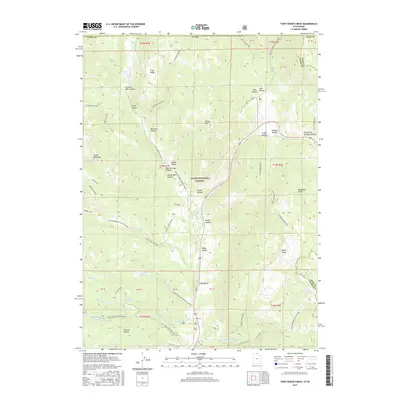
2017 Map of Tony Grove Creek
USGS Topo · Published 2017About this map
Logan Canyon serves as the central artery for this mountainous region of the Cache National Forest, where the Logan River and Tony Grove Creek converge. The terrain is defined by a complex network of canyons and hollows, including the notable Peter Sinks and the steep elevations of Beaver Mtn and Steam Mill Peak. Water resources are managed through several catchments such as Selman Reservoir, Rex Reservoir, and Goring Pond, reflecting the essential role of water storage in this high-elevation landscape. The map reveals an area dedicated to seasonal recreation and resource management, evidenced by the numerous winter sports routes like Tony Grove Winter Sports and Beaver Creek Winter Sport. These paths, alongside trails like the Turkey Trail GWT, indicate how the modern forest is utilized for both utility and leisure within the Cache and Rich county lines.
Find a feature on this map
61 named features on this map. Tap any name to fly to it.
Don’t see what you’re looking for? This feature index may not catch every label — zoom into the map to look around manually.
Map Details
Editions of this 2017 Tony Grove Creek Map
This is the sole edition of this map. No revisions or reprints were ever made.
Other maps of this area

1909 · Montpelier
USGS Topo · 1:125,000

1911 · Montpelier
USGS Topo · 1:125,000

1912 · Randolph
USGS Topo · 1:125,000

1914 · Logan
USGS Topo · 1:125,000

1915 · Preston
USGS Topo · 1:96,000

1916 · Logan
USGS Topo · 1:125,000

1918 · Preston
USGS Topo · 1:125,000

1954 · Ogden
USGS Topo · 1:250,000

1955 · Preston
USGS Topo · 1:250,000

1958 · Ogden
USGS Topo · 1:250,000