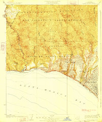
1928 Map of Topanga Canyon
USGS Topo · Published 1928About this map
The Santa Monica Mountains meet the Pacific in this 1920s survey, revealing the early coastal development of Los Angeles before the era of modern sprawl. The Coast Highway traces the shoreline, connecting established enclaves like Castellammare and Inceville to the growing community of Pacific Palisades. The landscape is a mix of rugged canyons and private holdings, with the Trippet Ranch, Claude Parker Ranch, and Uplitters Ranch occupying the high ground above the surf.
Find a feature on this map
35 named features on this map. Tap any name to fly to it.
Don’t see what you’re looking for? This feature index may not catch every label — zoom into the map to look around manually.
Map Details
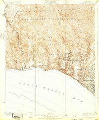
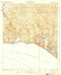
Editions of this 1928 Topanga Canyon Map
3 editions found
Other maps of this area

1894 · Los Angeles
USGS Topo · 1:62,500

1896 · Redondo
USGS Topo · 1:62,500

1896 · Santa Monica
USGS Topo · 1:62,500

1898 · Santa Monica
USGS Topo · 1:62,500

1900 · Los Angeles
USGS Topo · 1:62,500

1901 · Southern California Sheet No. 1
USGS Topo · 1:250,000

1902 · Santa Monica
USGS Topo · 1:62,500

1903 · Calabasas
USGS Topo · 1:62,500

1903 · Camulos
USGS Topo · 1:125,000

1904 · Southern California Sheet No. 1
USGS Topo · 1:250,000