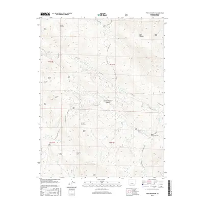
2016 Map of Topaz Mountain
USGS Topo · Published 2016About this map
Tarryall Mountains and the Kenosha Mountains converge in this high-altitude section of the Pike National Forest. The landscape is defined by a dense network of hiking and pack trails, including the prominent Colorado Trail and the Brookside-McCurdy Trail, which navigate the complex drainage systems of the N Fork Lost Cr and S Fork Lost Cr. These trails connect isolated geographical points such as Topaz Mtn, N Tarryall Peak, and the broad basin of Lost Park. Numerous named gulches and canyons, such as Black Canyon and Wallace Gulch, indicate a rugged topography carved by seasonal water flow. The map documents the intricate relationship between high peaks like the Platte River Mountains and the series of tributary creeks, including Craig Cr and Gooseberry Cr, that feed the larger watershed.
Find a feature on this map
40 named features on this map. Tap any name to fly to it.
Don’t see what you’re looking for? This feature index may not catch every label — zoom into the map to look around manually.
Map Details
Editions of this 2016 Topaz Mountain Map
This is the sole edition of this map. No revisions or reprints were ever made.
Other maps of this area

1893 · Platte Canyon
USGS Topo · 1:125,000

1945 · Bailey
USGS Topo · 1:24,000

1945 · Shawnee
USGS Topo · 1:24,000

1945 · Mount Logan
USGS Topo · 1:24,000

1948 · Mount Logan
USGS Topo · 1:24,000

1948 · Shawnee
USGS Topo · 1:24,000

1949 · Bailey
USGS Topo · 1:24,000

1953 · Denver
USGS Topo · 1:250,000
1954 · Windy Peak
USGS Topo · 1:24,000

1956 · Eagle Rock
USGS Topo · 1:24,000