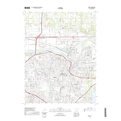
2018 Map of Topeka
USGS Topo · Published 2018About this map
Topeka serves as a dense urban and industrial hub at the confluence of the Kansas River and Shunganunga Creek in this 2018 survey. The map records several significant cultural and historical landmarks, most notably the Brown V. Board of Education National Historic Site and the prominent Burnett Mound to the southwest. The city's growth is framed by its various neighborhoods, including North Topeka, Oakland, and Highland Park, while the BNSF Railway and the Topeka Avenue Bridge underscore its role as a regional transit nexus. Genealogists will find a high concentration of burial grounds, such as Mount Hope Cem, Rochester Cem, and Pennwell-Gabel Cem and Mausoleum, providing a clear record of the community's established memorial sites alongside the Kansas ANG installations.
Find a feature on this map
122 named features on this map. Tap any name to fly to it.
Don’t see what you’re looking for? This feature index may not catch every label — zoom into the map to look around manually.
Map Details
Editions of this 2018 Topeka Map
This is the sole edition of this map. No revisions or reprints were ever made.
Other maps of this area

1889 · Burlingame
USGS Topo · 1:125,000

1889 · Topeka
USGS Topo · 1:125,000

1894 · Burlingame
USGS Topo · 1:125,000

1894 · Topeka
USGS Topo · 1:125,000

1947 · Lawrence
USGS Topo · 1:250,000

1950 · Kansas City
USGS Topo · 1:250,000

1950 · Lawrence
USGS Topo · 1:250,000

1950 · Topeka
USGS Topo · 1:24,000

1950 · Grantville
USGS Topo · 1:24,000

1951 · Grantville
USGS Topo · 1:24,000