
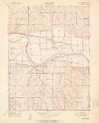
1951 Map of Grantville
USGS Topo · Published 1951About this map
The Kansas River meanders through this landscape, defining the transition between Shawnee and Jefferson counties. In the early 1950s, the rural character of the region is evident through an extensive network of country schoolhouses, including the Decker Sch and Millikin Sch. The river valley is a hub of transport and infrastructure, where the Union Pacific railroad parallels the water, serving the community of Grantville. South of the river, the Atchison Topeka and Santa Fe line connects Tecumseh and Spencer.
Find a feature on this map
42 named features on this map. Tap any name to fly to it.
Don’t see what you’re looking for? This feature index may not catch every label — zoom into the map to look around manually.
Map Details
Editions of this 1951 Grantville Map
2 editions found
Other maps of this area

1885 · Lawrence
USGS Topo · 1:125,000

1886 · Oskaloosa
USGS Topo · 1:125,000

1888 · Oskaloosa
USGS Topo · 1:125,000

1889 · Burlingame
USGS Topo · 1:125,000

1889 · Topeka
USGS Topo · 1:125,000

1889 · Lawrence
USGS Topo · 1:125,000

1894 · Burlingame
USGS Topo · 1:125,000

1894 · Oskaloosa
USGS Topo · 1:125,000

1894 · Topeka
USGS Topo · 1:125,000

1947 · Lawrence
USGS Topo · 1:250,000