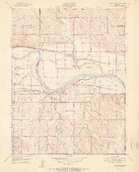
1951 Map of Grantville
USGS Topo · Published 1951About this map
Grantville and Tecumseh occupy opposing banks of the Kansas River in this mid-century portrait of eastern Kansas. The landscape is defined by the sweeping curves of the river and the complex drainage of tributaries like Muddy Creek, Little Muddy Creek, and Stinson Creek. The area’s industrial and civic infrastructure is prominently displayed, featuring the Topeka Municipal Airport and a large Power Plant near the riverbanks. Local genealogy is well-represented through numerous rural education sites including Millikin Sch and Decker Sch, alongside multiple cemeteries like Bethel Cem.
Find a feature on this map
42 named features on this map. Tap any name to fly to it.
Don’t see what you’re looking for? This feature index may not catch every label — zoom into the map to look around manually.
Map Details
Editions of this 1951 Grantville Map
2 editions found

Other maps of this area

1885 · Lawrence
USGS Topo · 1:125,000

1886 · Oskaloosa
USGS Topo · 1:125,000

1888 · Oskaloosa
USGS Topo · 1:125,000

1889 · Burlingame
USGS Topo · 1:125,000

1889 · Topeka
USGS Topo · 1:125,000

1889 · Lawrence
USGS Topo · 1:125,000

1894 · Burlingame
USGS Topo · 1:125,000

1894 · Oskaloosa
USGS Topo · 1:125,000

1894 · Topeka
USGS Topo · 1:125,000

1947 · Lawrence
USGS Topo · 1:250,000