1961 Map of Topopah Spring NW
USGS Topo · Published 1962About this map
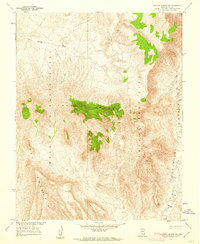
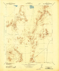
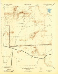
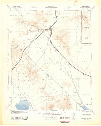
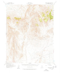
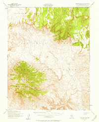
Yucca Mountain dominates this 1961 landscape in Nye County, a region defined by restricted military and scientific operations during the Cold War. Produced in cooperation with the Atomic Energy Commission, the map details the convergence of the Nellis Air Force Range and the Nevada Test Site, areas that remained tightly controlled for nuclear research and defense testing. The arid topography is marked by a complex network of canyons and drainage systems, most notably Forty Mile Canyon and the broad Forty Mile Wash. Numerous triangulation stations, such as VABM Yucca 6703 and VABM Leo 6195, are meticulously plotted across the high ridges. Despite the desolate character of the terrain, a solitary Spring and various Jeep Trails suggest the intermittent human presence required for monitoring and surveying these high-security desert reaches, while the Galico Hills rise in the southeast corner.
Find a feature on this map
17 named features on this map. Tap any name to fly to it.
Don’t see what you’re looking for? This feature index may not catch every label — zoom into the map to look around manually.
Map Details
Editions of this 1961 Topopah Spring NW Map
3 editions found
Other maps of this area

1908 · Kawich
USGS Topo · 1:250,000

1908 · Furnace Creek
USGS Topo · 1:250,000

1910 · Furnace Creek
USGS Topo · 1:250,000
1942 · Tolicha Peak
USGS Topo · 1:125,000
1942 · Wheelbarrow Peak
USGS Topo · 1:125,000
1942 · Skull Mountain
USGS Topo · 1:125,000
1942 · Bullfrog
USGS Topo · 1:125,000

1948 · Death Valley
USGS Topo · 1:250,000
1952 · Topopah Spring
USGS Topo · 1:62,500
1952 · Timber Mountain
USGS Topo · 1:62,500