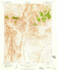
1952 Map of Topopah Spring
USGS Topo · Published 1958About this map
The Las Vegas Bombing and Gunnery Range dominates this mid-century survey of Nye County, reflecting the significant federal and military presence in the Nevada desert during the early Cold War era. Centered on the rugged convergence of Fortymile Canyon and Yucca Mountain, the landscape is defined by vast alluvial basins and arid drainage systems. The map detail shows the isolation of the high desert before major modern developments, with Topopah Spring serving as one of the few named water sources in the region. To the southeast, the open expanse of Jackass Flats is bordered by the distinctive Calico Hills, while Shoshone Mountain rises to the north. This topographic study is notable for its precise recording of numerous bench marks and the drainage patterns of Beatty Wash, providing a window into the natural state of this restricted territory in the 1950s.
Find a feature on this map
21 named features on this map. Tap any name to fly to it.
Don’t see what you’re looking for? This feature index may not catch every label — zoom into the map to look around manually.
Map Details
Editions of this 1952 Topopah Spring Map
4 editions found
Other maps of this area

1908 · Kawich
USGS Topo · 1:250,000

1908 · Furnace Creek
USGS Topo · 1:250,000

1910 · Furnace Creek
USGS Topo · 1:250,000

1942 · Tolicha Peak
USGS Topo · 1:125,000

1942 · Wheelbarrow Peak
USGS Topo · 1:125,000

1942 · Skull Mountain
USGS Topo · 1:125,000

1942 · Bullfrog
USGS Topo · 1:125,000

1948 · Death Valley
USGS Topo · 1:250,000

1952 · Topopah Spring
USGS Topo · 1:62,500

1952 · Big Dune
USGS Topo · 1:62,500