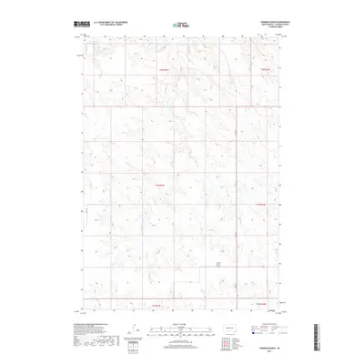
2017 Map of Tornado Ranch
USGS Topo · Published 2017About this map
Tornado Ranch sits within a sparsely settled landscape of central Haakon County, where the topography is defined by the drainages of Cottonwood Cr and W Plum Cr. This region of South Dakota is characterized by its expansive sections and township lines, reflecting a history of late homesteading and ranching development. The map details the precise alignment of rural roads like 229th Ave and 216th St, which trace the section lines typical of the Great Plains' rectangular survey system. The namesake Tornado Ranch is a primary point of interest in this section of the western prairie, illustrating the continued significance of large ranching operations in maintaining the local economy and land-use patterns into the twenty-first century.
Find a feature on this map
12 named features on this map. Tap any name to fly to it.
Don’t see what you’re looking for? This feature index may not catch every label — zoom into the map to look around manually.
Map Details
Editions of this 2017 Tornado Ranch Map
This is the sole edition of this map. No revisions or reprints were ever made.
Other maps of this area

1954 · Pierre
USGS Topo · 1:250,000

1958 · Pierre
USGS Topo · 1:250,000

1983 · Mule Creek
USGS Topo · 1:24,000

1983 · Philip
USGS Topo · 1:100,000
1983 · Elevenmile Corner
USGS Topo · 1:24,000

1983 · Milesville
USGS Topo · 1:24,000

1983 · Middle Draw
USGS Topo · 1:24,000

1983 · Powell NW
USGS Topo · 1:24,000

1983 · Tornado Ranch
USGS Topo · 1:24,000
1983 · Lucerne
USGS Topo · 1:24,000