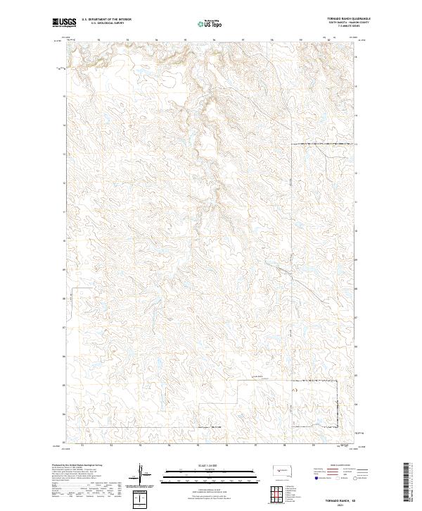
2021 Map of Tornado Ranch
USGS Topo · Published 2021About this map
Tornado Ranch serves as the primary landmark in this rural expanse of Haakon County, situated near the intersection of 216th St and 229th Ave. The terrain is defined by a dendritic drainage pattern typical of the western South Dakota plains, where seasonal waterways like Cottonwood Cr and Plum Cr carve paths through the section lines. These watercourses, including the tributary W Plum Cr, dictate the movement and settlement patterns across the townships of T5N, T4N, and T3N. The sparse road network, featuring Tornado Ranch Rd and 224th Ave, follows the rigid grid of the Public Land Survey System, illustrating the late-twentieth and early-twenty-first-century ranching infrastructure of this Great Plains landscape.
Find a feature on this map
14 named features on this map. Tap any name to fly to it.
Don’t see what you’re looking for? This feature index may not catch every label — zoom into the map to look around manually.
Map Details
Editions of this 2021 Tornado Ranch Map
This is the sole edition of this map. No revisions or reprints were ever made.
Other maps of this area

1954 · Pierre
USGS Topo · 1:250,000

1958 · Pierre
USGS Topo · 1:250,000

1983 · Mule Creek
USGS Topo · 1:24,000

1983 · Philip
USGS Topo · 1:100,000
1983 · Elevenmile Corner
USGS Topo · 1:24,000

1983 · Milesville
USGS Topo · 1:24,000

1983 · Middle Draw
USGS Topo · 1:24,000

1983 · Powell NW
USGS Topo · 1:24,000

1983 · Tornado Ranch
USGS Topo · 1:24,000
1983 · Lucerne
USGS Topo · 1:24,000