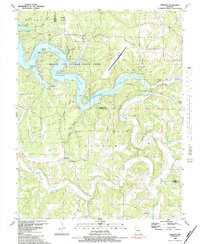
1983 Map of Toronto
USGS Topo · Published 1983About this map
The Grandglaize Arm of the Lake of the Ozarks dominates the northern half of this landscape, where the waters of the Ozarks fill the deep-cut valleys of the Missouri Ozark Plateau. This early 1980s record includes underwater contours for the lake sourced from 1920s and 1930s Union Electric Company charts, revealing the pre-inundation topography of the Grandglaize Arm. Significant recreational and infrastructure developments are evident, from the Lee C Fine Memorial Airport and Kaiser Lookout Tower to the extensive boundaries of Lake of the Ozarks State Park.
Find a feature on this map
51 named features on this map. Tap any name to fly to it.
Don’t see what you’re looking for? This feature index may not catch every label — zoom into the map to look around manually.
Map Details
Editions of this 1983 Toronto Map
2 editions found
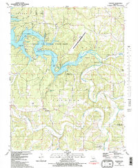
Other maps of this area

1888 · Versailles
USGS Topo · 1:125,000

1888 · Tuscumbia
USGS Topo · 1:125,000

1893 · Versailles
USGS Topo · 1:125,000

1894 · Tuscumbia
USGS Topo · 1:125,000

1932 · Versailles No 4
USGS Topo · 1:48,000

1933 · Stoutland
USGS Topo · 1:62,500

1933 · Iberia
USGS Topo · 1:62,500

1934 · Camdenton
USGS Topo · 1:24,000

1934 · Toronto
USGS Topo · 1:24,000

1934 · Lake Ozark
USGS Topo · 1:24,000