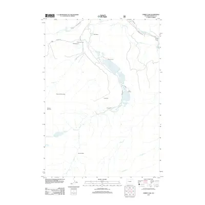
2012 Map of Torrey Lake
USGS Topo · Published 2012About this map
Torrey Lake, Ring Lake, and Trail Lake form a distinctive linear chain of glacial water bodies at the base of the Torrey Rim. This 2012 study of the Fremont County landscape reveals a pattern of ranching operations established along the valley floor, including the Torrey Lake Ranch, Ring Lake Ranch, and Trail Lake Ranch. The rugged terrain to the west is dominated by the massive bulk of Whiskey Mountain and the protected lands of the Glacier Primitive Area. Evidence of early water management for agriculture is visible in the north, where the Diamond Ditch and Carson Ditch draw from the Wind River. High-altitude features like Bomber Basin and Bomber Falls sit in the southern reaches, highlighting the dramatic elevation changes characteristic of this portion of the Wind River Range.
Find a feature on this map
36 named features on this map. Tap any name to fly to it.
Don’t see what you’re looking for? This feature index may not catch every label — zoom into the map to look around manually.
Map Details
Editions of this 2012 Torrey Lake Map
This is the sole edition of this map. No revisions or reprints were ever made.
Other maps of this area

1904 · Kirwin
USGS Topo · 1:125,000

1905 · Younts Peak
USGS Topo · 1:125,000

1906 · Kirwin
USGS Topo · 1:125,000

1907 · Younts Peak
USGS Topo · 1:125,000

1909 · Fremont Peak
USGS Topo · 1:125,000

1952 · Hays Park
USGS Topo · 1:24,000

1952 · Blue Holes
USGS Topo · 1:24,000

1955 · Thermopolis
USGS Topo · 1:250,000

1956 · Dubois
USGS Topo · 1:24,000

1956 · Mason Draw
USGS Topo · 1:24,000