
1956 Map of Dubois
USGS Topo · Published 1958About this map
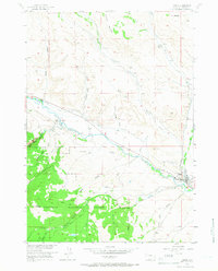
Dubois sits at the heart of this mid-century survey, where the Wind River cuts through the high desert of Fremont County. This era shows a community dependent on water management and high-country ranching, evidenced by the intricate system of irrigation including the Green Ditch and Holmes No 1 Ditch that lace across the flats near Tappan Creek. The landscape transitions sharply from the ranch lands of Shipley Ranch and Harrison Ranch in the north to the dense timber of the Shoshone National Forest in the southwest, where peaks like Bald Mountain overlook the drainage of Little Warm Spring Creek. Notable infrastructure of the time includes the Dubois Airport and a nearby Landing Field (Aband), reflecting the evolution of regional aviation. The map also captures several family-named landmarks and water sources like Mud Spring and Hart Reservoir, essential markers for local history and genealogy research.
Find a feature on this map
32 named features on this map. Tap any name to fly to it.
Don’t see what you’re looking for? This feature index may not catch every label — zoom into the map to look around manually.
Map Details
Editions of this 1956 Dubois Map
4 editions found
Other maps of this area

1905 · Younts Peak
USGS Topo · 1:125,000

1907 · Younts Peak
USGS Topo · 1:125,000

1909 · Fremont Peak
USGS Topo · 1:125,000

1955 · Thermopolis
USGS Topo · 1:250,000

1956 · Indian Point
USGS Topo · 1:24,000

1956 · Esmond Park
USGS Topo · 1:24,000

1956 · Ramshorn Peak
USGS Topo · 1:24,000

1956 · Warm Spring Mountain
USGS Topo · 1:24,000

1956 · Mason Draw
USGS Topo · 1:24,000

1958 · Thermopolis
USGS Topo · 1:250,000