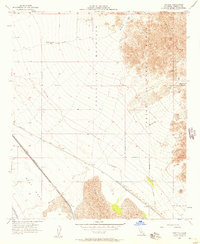
1955 Map of Tortuga
USGS Topo · Published 1957About this map
The Southern Pacific Railroad corridor through the Imperial Valley desert serves as the primary artery for the small siding of Tortuga. This mid-century landscape is defined by the stark contrast between the arid East Mesa and the vital water infrastructure of the Coachella Canal and East Highline Canal. The industrial and military footprint of the era is evident in the sprawling Chocolate Mountain Aerial Gunnery Range, which occupies the rugged terrain to the north and east.
Find a feature on this map
9 named features on this map. Tap any name to fly to it.
Don’t see what you’re looking for? This feature index may not catch every label — zoom into the map to look around manually.
Map Details
Editions of this 1955 Tortuga Map
3 editions found
Other maps of this area

1940 · Iris
USGS Topo · 1:62,500

1940 · Iris Pass
USGS Topo · 1:62,500

1945 · Iris Pass
USGS Topo · 1:62,500

1945 · Iris
USGS Topo · 1:62,500

1953 · Acolita
USGS Topo · 1:24,000

1953 · Chuckwalla Spring
USGS Topo · 1:62,500

1953 · Acolita
USGS Topo · 1:62,500

1954 · Salton Sea
USGS Topo · 1:250,000

1955 · Tortuga
USGS Topo · 1:24,000

1955 · Salton Sea
USGS Topo · 1:250,000