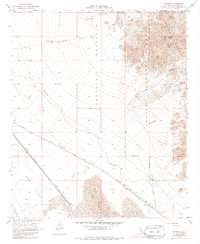
1955 Map of Tortuga
USGS Topo · Published 1985About this map
The Chocolate Mountains dominate this arid landscape where the Imperial Valley desert meets military and water infrastructure. Based on 1950s fieldwork, the map documents the Coachella Canal as it skirts the East Mesa, a critical lifeline for Colorado River water distribution. The small settlement of Tortuga and the adjacent Southern Pacific Road parallel the canal, serving as a corridor through the expansive Sand Hills. To the east, the terrain rises into the Aerial Gunnery Range, marked by a hard Naval Reservation Boundary and specialized routes like the Salvation Pass Trail. Numerous dry wells, such as Barth Well and Hayden Well, reflect the challenges of the environment, while the presence of an Old Railroad Grade and a Gravel Pit suggest a history of resource extraction and transit development in this remote corner of Imperial County.
Find a feature on this map
21 named features on this map. Tap any name to fly to it.
Don’t see what you’re looking for? This feature index may not catch every label — zoom into the map to look around manually.
Map Details
Editions of this 1955 Tortuga Map
3 editions found
Other maps of this area

1940 · Iris
USGS Topo · 1:62,500

1940 · Iris Pass
USGS Topo · 1:62,500

1945 · Iris Pass
USGS Topo · 1:62,500

1945 · Iris
USGS Topo · 1:62,500

1953 · Acolita
USGS Topo · 1:24,000

1953 · Chuckwalla Spring
USGS Topo · 1:62,500

1953 · Acolita
USGS Topo · 1:62,500

1954 · Salton Sea
USGS Topo · 1:250,000

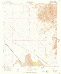
1955 · Tortuga
USGS Topo · 1:24,000

1955 · Salton Sea
USGS Topo · 1:250,000