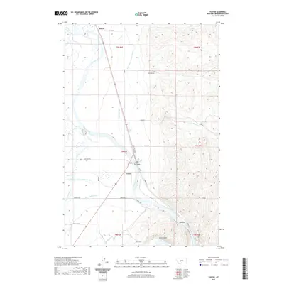
2020 Map of Toston
USGS Topo · Published 2020About this map
The Missouri River carves a central path through this Broadwater County landscape, defining the local geography around the settlement of Toston. This area is characterized by an intricate network of irrigation and water management infrastructure, including the Broadwater-Missouri Canal, Big Springs Ditch, and Lombard Canal, which support agriculture in the river valley. The community of Toston sits at a critical crossing point where the Missouri River Bridge and nearby rail-related features like the Toston Tunnel navigate the winding waterway. To the north and south, smaller locales such as Holker and Brewer anchor the riverbanks. The terrain transitions from the low-lying river bottom at Devils Bottom to the rising elevations of Dry Hollow. This map documents a modern landscape still fundamentally tied to the Missouri's flow and the complex system of canals, such as the Willow Swamp Canal and Toston Canal, that distribute its water across the plains.
Find a feature on this map
41 named features on this map. Tap any name to fly to it.
Don’t see what you’re looking for? This feature index may not catch every label — zoom into the map to look around manually.
Map Details
Editions of this 2020 Toston Map
This is the sole edition of this map. No revisions or reprints were ever made.
Other maps of this area

1886 · Fort Logan
USGS Topo · 1:250,000

1948 · White Sulphur Springs
USGS Topo · 1:250,000

1949 · Radersburg
USGS Topo · 1:62,500

1949 · Toston
USGS Topo · 1:62,500

1950 · Townsend
USGS Topo · 1:62,500

1950 · Duck Creek Pass
USGS Topo · 1:62,500

1958 · White Sulphur Springs
USGS Topo · 1:250,000

1961 · White Sulphur Springs
USGS Topo · 1:250,000

1965 · White Sulphur Springs
USGS Topo · 1:250,000

1976 · Townsend
USGS Topo · 1:100,000