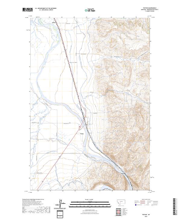
2024 Map of Toston
USGS Topo · Published 2024About this map
The Missouri River carves a central path through this Broadwater County landscape, defining a valley dominated by a complex network of 21st-century irrigation infrastructure. The small community of Toston sits at a critical junction where the river meets the Broadwater - Missouri Canal and the Big Springs Ditch, reflecting the long-standing importance of water management in this part of Montana. From Holker in the north to Brewer in the south, the terrain transitions from the fertile river bottoms near Devils Bottom to the rising elevations of Dry Hollow and the foothills to the east.
Find a feature on this map
36 named features on this map. Tap any name to fly to it.
Don’t see what you’re looking for? This feature index may not catch every label — zoom into the map to look around manually.
Map Details
Editions of this 2024 Toston Map
This is the sole edition of this map. No revisions or reprints were ever made.
Other maps of this area

1886 · Fort Logan
USGS Topo · 1:250,000

1948 · White Sulphur Springs
USGS Topo · 1:250,000

1949 · Radersburg
USGS Topo · 1:62,500

1949 · Toston
USGS Topo · 1:62,500

1950 · Townsend
USGS Topo · 1:62,500

1950 · Duck Creek Pass
USGS Topo · 1:62,500

1958 · White Sulphur Springs
USGS Topo · 1:250,000

1961 · White Sulphur Springs
USGS Topo · 1:250,000

1965 · White Sulphur Springs
USGS Topo · 1:250,000

1976 · Townsend
USGS Topo · 1:100,000