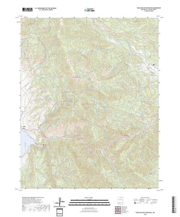
2023 Map of Touch-Me-Not Mountain
USGS Topo · Published 2023About this map
Touch-Me-Not Mountain anchors the high country of the Cimarron Range, where high-altitude drainages like Humbug Gulch and Ute Creek carve into the mountain's northern slopes. To the west, the settlement of Eagle Nest sits on the edge of Eagle Nest Lake, a significant water resource for this pocket of Colfax County. The landscape is defined by its deep vertical relief, most notably in the south where the Cimarron River winds through the steep confines of Cimarron Canyon below the dramatic Palisades rock formations.
Find a feature on this map
27 named features on this map. Tap any name to fly to it.
Don’t see what you’re looking for? This feature index may not catch every label — zoom into the map to look around manually.
Map Details
Editions of this 2023 Touch-Me-Not Mountain Map
This is the sole edition of this map. No revisions or reprints were ever made.
Other maps of this area

1954 · Raton
USGS Topo · 1:250,000

1955 · Ute Park
USGS Topo · 1:62,500

1956 · Tooth Of Time
USGS Topo · 1:62,500

1958 · Raton
USGS Topo · 1:250,000

1963 · Eagle Nest
USGS Topo · 1:24,000

1963 · Red River Pass
USGS Topo · 1:24,000

1965 · Palo Flechado Pass
USGS Topo · 1:24,000

1982 · Wheeler Peak
USGS Topo · 1:100,000

1983 · Taos
USGS Topo · 1:100,000
1987 · Ute Park
USGS Topo · 1:24,000