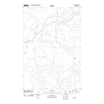
2011 Map of Toutle
USGS Topo · Published 2011About this map
The confluence of the North Fork Toutle River and South Fork Toutle River dominates this 2011 survey, showing a landscape defined by its recovery and ongoing management. The settlement of Toutle sits near the western edge, while landmarks like the Coal Bank Bridge and the South Fork Toutle Debris Dam indicate the critical infrastructure required to navigate and stabilize this river-carved terrain. The map details the intricate network of logging and local access roads such as Toutle Ridge Dr, Sightly Rd, and Locksley Rd, which branch off toward the smaller community of Sightly.
Find a feature on this map
33 named features on this map. Tap any name to fly to it.
Don’t see what you’re looking for? This feature index may not catch every label — zoom into the map to look around manually.
Map Details
Editions of this 2011 Toutle Map
This is the sole edition of this map. No revisions or reprints were ever made.
Other maps of this area

1921 · Kalama
USGS Topo · 1:62,500

1941 · Olequa
USGS Topo · 1:62,500

1942 · Toutle
USGS Topo · 1:62,500

1943 · Pigeon Springs
USGS Topo · 1:62,500

1953 · Hoquiam
USGS Topo · 1:250,000

1953 · Toutle
USGS Topo · 1:62,500

1953 · Castle Rock
USGS Topo · 1:62,500

1953 · Mt. Brynion
USGS Topo · 1:24,000

1953 · Pigeon Springs
USGS Topo · 1:62,500

1957 · Hoquiam
USGS Topo · 1:250,000