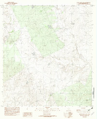
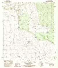
1982 Map of Tovar Creek East
USGS Topo · Published 1982About this map
Tovar Creek and San Ambrosia Creek wind through this part of Maverick County, shaping a landscape defined by intermittent water sources and ranching infrastructure. This 1982 provisional survey captures the area's transition into the late 20th century, where traditional land use is evident through numerous named stock tanks such as Coyote Tank, Green Tank, and South Tank. These water features were essential for livestock in the semi-arid South Texas brush country. Evidence of modern accessibility is found in the Landing Strips located in the western portion of the map, likely serving remote ranching operations or private transport. Further south, the drainage of Borrego Creek cuts through the terrain, illustrating the natural watershed patterns of the region before significant modern development altered the rural character of the Maverick County interior.
Find a feature on this map
8 named features on this map. Tap any name to fly to it.
Don’t see what you’re looking for? This feature index may not catch every label — zoom into the map to look around manually.
Map Details
Editions of this 1982 Tovar Creek East Map
This is the sole edition of this map. No revisions or reprints were ever made.
Other maps of this area

1940 · Chupadera
USGS Topo · 1:62,500

1941 · Botella Creek
USGS Topo · 1:62,500

1957 · Indio Creek
USGS Topo · 1:62,500

1957 · Botella Creek
USGS Topo · 1:62,500

1958 · Eagle Pass
USGS Topo · 1:250,000

1965 · Eagle Pass
USGS Topo · 1:250,000
1982 · Indio Tank
USGS Topo · 1:24,000
1982 · San Pedro Creek
USGS Topo · 1:24,000
1983 · Tovar Creek West
USGS Topo · 1:24,000
1983 · Salt Well
USGS Topo · 1:24,000