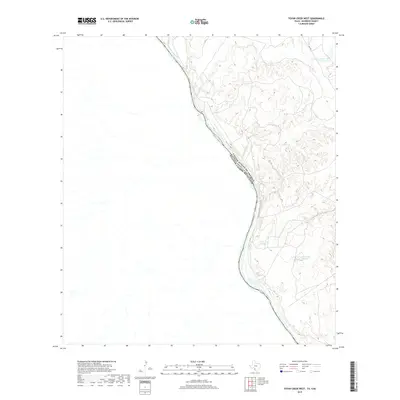
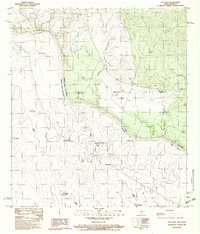
2019 Map of Tovar Creek West
USGS Topo · Published 2019About this map
The Rio Grande serves as the dominant geographical and political boundary in this 2019 survey of Maverick County, marking the border between the United States and Mexico. This sparsely populated riverine landscape is defined by its drainage systems and managed water resources, such as Cage Lake Number 2 and the adjacent Carter Lake Number 1 and Carter Lake Number 2. These features, along with intermittent waterways like Cuervo Cr and Tovar Cr, suggest a terrain primarily shaped by seasonal water flow and livestock ranching. The map illustrates how human development in this borderland is limited to essential water management and access routes, preserving the stark character of the desert shrubland near the international line.
Find a feature on this map
7 named features on this map. Tap any name to fly to it.
Don’t see what you’re looking for? This feature index may not catch every label — zoom into the map to look around manually.
Map Details
Editions of this 2019 Tovar Creek West Map
This is the sole edition of this map. No revisions or reprints were ever made.
Other maps of this area

1940 · Chupadera
USGS Topo · 1:62,500

1941 · Botella Creek
USGS Topo · 1:62,500

1957 · Indio Creek
USGS Topo · 1:62,500

1957 · Botella Creek
USGS Topo · 1:62,500

1958 · Eagle Pass
USGS Topo · 1:250,000

1965 · Eagle Pass
USGS Topo · 1:250,000
1982 · Tovar Creek East
USGS Topo · 1:24,000
1982 · Indio Tank
USGS Topo · 1:24,000
1983 · Tovar Creek West
USGS Topo · 1:24,000
1983 · Salt Well
USGS Topo · 1:24,000