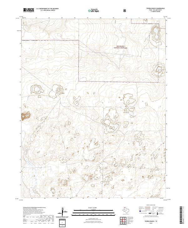
2022 Map of Tovrea Ranch
USGS Topo · Published 2022About this map
Rita Blanca National Grassland dominates the northern reaches of this landscape in the Texas Panhandle. This portion of Dallam County is characterized by the winding path of Rita Blanca Cr, which cuts through the high plains terrain. The map illustrates a primarily open ranching landscape, where ephemeral water sources and subtle topographic shifts define the character of the land. Historically, this area represents the restoration of the Dust Bowl-era plains, where the federal government consolidated lands to stabilize the soil and preserve the shortgrass prairie. The scarcity of named settlements highlights the vast, unpopulated nature of the high plains, where the primary landmarks are natural drainage features and the boundaries of the national grassland itself.
Find a feature on this map
2 named features on this map. Tap any name to fly to it.
Don’t see what you’re looking for? This feature index may not catch every label — zoom into the map to look around manually.
Map Details
Editions of this 2022 Tovrea Ranch Map
This is the sole edition of this map. No revisions or reprints were ever made.
Other maps of this area

1954 · Dalhart
USGS Topo · 1:250,000

1958 · Dalhart
USGS Topo · 1:250,000

1962 · Dalhart
USGS Topo · 1:250,000

1973 · Buffalo Springs
USGS Topo · 1:24,000

1973 · Wharton Ranch
USGS Topo · 1:24,000

1973 · Tovrea Ranch
USGS Topo · 1:24,000

1973 · Perico
USGS Topo · 1:24,000

1973 · Bolin NE
USGS Topo · 1:24,000

1973 · Bolin
USGS Topo · 1:24,000
1973 · Coldwater West
USGS Topo · 1:24,000