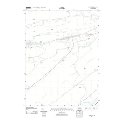
2010 Map of Tower City
USGS Topo · Published 2010About this map
Tower City and Williamstown anchor this landscape, situated along the Wiconisco Creek valley in the shadows of the anthracite coal region's ridges. The map illustrates a developed corridor at the base of Big Lick Mountain, where the built environment of residential streets and cemeteries like Fairview Cemetery transitions into the steep, wooded terrain of Bear Mountain. The presence of the Williamstown Tunnel and local landmarks like the Gold Mine Speedway point to the area's industrial and recreational history. To the south, the terrain becomes more expansive and less settled, defined by the winding paths of Clark Creek and the Evening Branch, which flow through the gaps between Second Mountain and the prominent Chinese Wall formation. This 2010 survey details the modern infrastructure of Hegins Township, from the Bendigo Airport to the Lebanon Reservoir, providing a clear picture of the region's topographical and civil layout.
Find a feature on this map
47 named features on this map. Tap any name to fly to it.
Don’t see what you’re looking for? This feature index may not catch every label — zoom into the map to look around manually.
Map Details
Editions of this 2010 Tower City Map
This is the sole edition of this map. No revisions or reprints were ever made.
Other maps of this area

1891 · Lebanon
USGS Topo · 1:62,500

1892 · Lykens
USGS Topo · 1:62,500

1892 · Hummelstown
USGS Topo · 1:62,500

1892 · Pine Grove
USGS Topo · 1:62,500

1893 · Lykens
USGS Topo · 1:62,500

1893 · Lebanon
USGS Topo · 1:62,500

1899 · Lebanon
USGS Topo · 1:62,500

1924 · Hummelstown
USGS Topo · 1:62,500

1943 · Lebanon
USGS Topo · 1:62,500

1943 · Lykens
USGS Topo · 1:62,500
Featured Places
- Hegins Township, PA
- Williamstown, PA
- Tower City, Porter Township
- Cold Spring Township, PA
- Hubley Township, PA