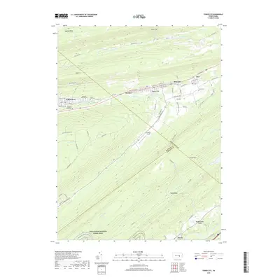
2019 Map of Tower City
USGS Topo · Published 2019About this map
The ridge-and-valley corridor of the Wiconisco Valley is defined by a dense string of settlements including Williamstown, Sheridan, Tower City, Reinerton, Muir, and Orwin. This residential and industrial belt sits south of the Big Lick Mountain area, where the Williamstown Tunnel and the waters of W Br Rausch Cr mark a landscape historically shaped by coal interests. The map preserves the location of several significant burial grounds, such as the Sacred Heart Cem and Methodist Episcopal Cem, which serve as vital touchstones for family historians and genealogists in this part of Schuylkill County.
Find a feature on this map
78 named features on this map. Tap any name to fly to it.
Don’t see what you’re looking for? This feature index may not catch every label — zoom into the map to look around manually.
Map Details
Editions of this 2019 Tower City Map
This is the sole edition of this map. No revisions or reprints were ever made.
Other maps of this area

1891 · Lebanon
USGS Topo · 1:62,500

1892 · Lykens
USGS Topo · 1:62,500

1892 · Hummelstown
USGS Topo · 1:62,500

1892 · Pine Grove
USGS Topo · 1:62,500

1893 · Lykens
USGS Topo · 1:62,500

1893 · Lebanon
USGS Topo · 1:62,500

1899 · Lebanon
USGS Topo · 1:62,500

1924 · Hummelstown
USGS Topo · 1:62,500

1943 · Lebanon
USGS Topo · 1:62,500

1943 · Lykens
USGS Topo · 1:62,500
Featured Places
- Hegins Township, PA
- Williamstown, PA
- Tower City, Porter Township
- Cold Spring Township, PA
- Hubley Township, PA