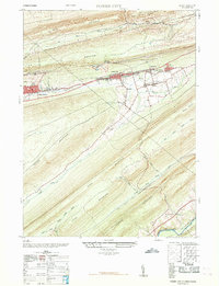
1968 Map of Tower City
USGS Topo · Published 1968About this map
Tower City and the neighboring boroughs of Williamstown and Reinerton sit at the center of this 1968 topographic study, illustrating the dense settlement patterns typical of Pennsylvania's coal regions. The landscape is defined by the massive parallel ridges of Bear Mountain and Big Lick Mountain, which constrain development to the narrow valley of Wiconisco Creek. Industrial legacies are clearly visible through features such as the Abandoned Coal Breaker and an Abandoned Mine Tunnel, marking the extraction history that built these communities. Local life is documented through the presence of the Porter Township High School, several rural schools like Orwin School, and religious centers including Union Church and Luth Church. The southern portion of the map transitions into the steep, wooded slopes of Stony Mountain and Second Mountain, where recreation is noted at Twin Grove Park near the banks of Swatara Creek.
Find a feature on this map
40 named features on this map. Tap any name to fly to it.
Don’t see what you’re looking for? This feature index may not catch every label — zoom into the map to look around manually.
Map Details
Editions of this 1968 Tower City Map
This is the sole edition of this map. No revisions or reprints were ever made.
Other maps of this area

1891 · Lebanon
USGS Topo · 1:62,500

1892 · Lykens
USGS Topo · 1:62,500

1892 · Hummelstown
USGS Topo · 1:62,500

1892 · Pine Grove
USGS Topo · 1:62,500

1893 · Lykens
USGS Topo · 1:62,500

1893 · Lebanon
USGS Topo · 1:62,500

1899 · Lebanon
USGS Topo · 1:62,500

1924 · Hummelstown
USGS Topo · 1:62,500

1943 · Lebanon
USGS Topo · 1:62,500

1943 · Lykens
USGS Topo · 1:62,500
Featured Places
- Hegins Township, PA
- Williamstown, PA
- Tower City, Porter Township
- Jackson Township, PA
- Jefferson Township, PA