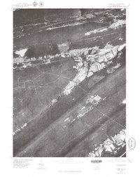
1977 Map of Tower City
USGS Topo · Published 1979About this map
The ridge-and-valley landscape of western Schuylkill County is captured here in striking detail through a late 1970s orthophotoquad. The narrow corridor of settlement follows the base of Big Lick Mountain, where the community of Tower City anchors a string of small towns including Orwin and Muir. This development pattern is dictated by the dramatic parallel ridges of the Appalachians, with the valley floors supporting both industry and residential growth along the banks of Wiconisco Creek. To the south, the terrain becomes increasingly complex as it rises into the steep, wooded slopes of Sharp Mountain, Stony Mountain, and Second Mountain. The aerial imagery clearly shows the footprint of coal-related land use and the grid patterns of established settlements like Wiconisco as they existed during the late twentieth century.
Find a feature on this map
9 named features on this map. Tap any name to fly to it.
Don’t see what you’re looking for? This feature index may not catch every label — zoom into the map to look around manually.
Map Details
Editions of this 1977 Tower City Map
This is the sole edition of this map. No revisions or reprints were ever made.
Other maps of this area

1891 · Lebanon
USGS Topo · 1:62,500

1892 · Lykens
USGS Topo · 1:62,500

1892 · Hummelstown
USGS Topo · 1:62,500

1892 · Pine Grove
USGS Topo · 1:62,500

1893 · Lykens
USGS Topo · 1:62,500

1893 · Lebanon
USGS Topo · 1:62,500

1899 · Lebanon
USGS Topo · 1:62,500

1924 · Hummelstown
USGS Topo · 1:62,500

1943 · Lebanon
USGS Topo · 1:62,500

1943 · Lykens
USGS Topo · 1:62,500
Featured Places
- Hegins Township, PA
- Williamstown, PA
- Tower City, Porter Township
- Jackson Township, PA
- Jefferson Township, PA