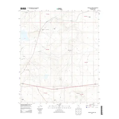
2013 Map of Tower Hill North
USGS Topo · Published 2013About this map
Clayton Basin and the winding Gatuna Canyon define the arid topography of this Eddy County landscape. Historically significant for its ranching roots, the area is anchored by Lusk Ranch in the northeast and Wood Ranch further south. The terrain is marked by prominent natural boundaries including Nimenim Ridge, Mimosa Ridge, and the Maroon Cliffs, while Tower Hill serves as a central landmark. A network of rural routes, such as Crazy Horse Rd, Curry Comb Rd, and Colt Rd, provides access across the township lines. This 2013 survey illustrates the enduring patterns of land use in a region where geological features and private ranch holdings dictate the layout of the desert floor.
Find a feature on this map
22 named features on this map. Tap any name to fly to it.
Don’t see what you’re looking for? This feature index may not catch every label — zoom into the map to look around manually.
Map Details
Editions of this 2013 Tower Hill North Map
This is the sole edition of this map. No revisions or reprints were ever made.
Other maps of this area

1939 · Carlsbad
USGS Topo · 1:62,500

1939 · Nash Draw
USGS Topo · 1:62,500

1942 · Clayton Basin
USGS Topo · 1:62,500

1943 · Carlsbad
USGS Topo · 1:62,500

1943 · Clayton Basin
USGS Topo · 1:62,500

1943 · Oil City
USGS Topo · 1:62,500

1943 · Nash Draw
USGS Topo · 1:62,500

1954 · Carlsbad
USGS Topo · 1:250,000

1954 · Hobbs
USGS Topo · 1:250,000

1958 · Carlsbad
USGS Topo · 1:250,000