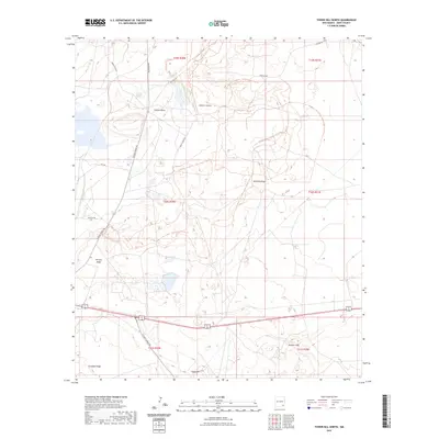
2023 Map of Tower Hill North
USGS Topo · Published 2023About this map
Clayton Basin and the surrounding high desert of Eddy County are defined by a complex network of industrial access roads and recreational paths in this recent survey. The landscape is marked by a series of prominent geological features, including the rising heights of Tower Hill and the distinctive Maroon Cliffs. Significant transport infrastructure like Potash Mines Rd and Shugart Rd provides access to this resource-rich corner of New Mexico, while the Hackberry Trail System - South Shugart Trails Trl weaves through the breaks and canyons.
Find a feature on this map
24 named features on this map. Tap any name to fly to it.
Don’t see what you’re looking for? This feature index may not catch every label — zoom into the map to look around manually.
Map Details
Editions of this 2023 Tower Hill North Map
This is the sole edition of this map. No revisions or reprints were ever made.
Other maps of this area

1939 · Carlsbad
USGS Topo · 1:62,500

1939 · Nash Draw
USGS Topo · 1:62,500

1942 · Clayton Basin
USGS Topo · 1:62,500

1943 · Carlsbad
USGS Topo · 1:62,500

1943 · Clayton Basin
USGS Topo · 1:62,500

1943 · Oil City
USGS Topo · 1:62,500

1943 · Nash Draw
USGS Topo · 1:62,500

1954 · Carlsbad
USGS Topo · 1:250,000

1954 · Hobbs
USGS Topo · 1:250,000

1958 · Carlsbad
USGS Topo · 1:250,000