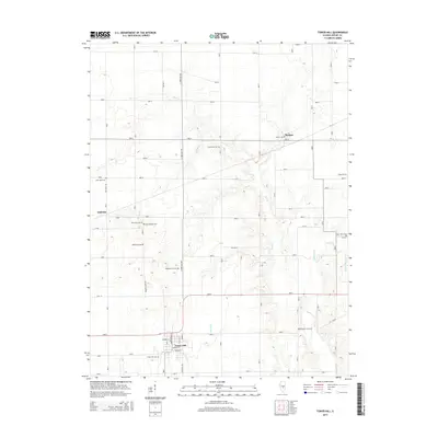
2015 Map of Tower Hill
USGS Topo · Published 2015About this map
The village of Tower Hill serves as the primary hub in this southern Shelby County landscape, with a grid of streets including Benton St, Dayton St, and Michigan St concentrated south of the regional highway. The surrounding terrain is defined by a dense network of burial grounds and small rural communities like Dollville and Henton. These features suggest a long-established agricultural settlement pattern where local history is preserved in small, scattered sites such as Knobs Baptist Cem, Saint Paul Cem, and Middlesworth Cem. Natural drainage follows the meandering paths of Mud Cr and Robinson Cr, which cut through the section lines of the township. Local roads like Dollville Rd and Knobs Church Rd provide access to these inland points, connecting the smaller hamlets to the central village and its nearby Tower Hill Cem.
Find a feature on this map
29 named features on this map. Tap any name to fly to it.
Don’t see what you’re looking for? This feature index may not catch every label — zoom into the map to look around manually.
Map Details
Editions of this 2015 Tower Hill Map
This is the sole edition of this map. No revisions or reprints were ever made.
Other maps of this area

1942 · Shelbyville
USGS Topo · 1:62,500

1946 · Shelbyville
USGS Topo · 1:62,500

1947 · Pana
USGS Topo · 1:62,500

1949 · Dalton City
USGS Topo · 1:62,500

1949 · Pana
USGS Topo · 1:62,500

1952 · Assumption
USGS Topo · 1:62,500

1958 · Decatur
USGS Topo · 1:250,000

1961 · Decatur
USGS Topo · 1:250,000
1981 · Fancher
USGS Topo · 1:24,000
1981 · Shelbyville
USGS Topo · 1:24,000