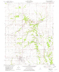
1981 Map of Tower Hill
USGS Topo · Published 1982About this map
Tower Hill serves as the primary hub of this Shelby County landscape, where the Baltimore and Ohio and Conrail lines intersect. The map reveals a highly structured agricultural and transport network, featuring the small settlements of Henton and Dollville along the Missouri Pacific corridor. The rural character is defined by a dense distribution of local institutions, including Robinson Creek Ch and Knobs Ch, alongside numerous family and community burial grounds such as Armstrong Cem and Craig Cem.
Find a feature on this map
36 named features on this map. Tap any name to fly to it.
Don’t see what you’re looking for? This feature index may not catch every label — zoom into the map to look around manually.
Map Details
Editions of this 1981 Tower Hill Map
This is the sole edition of this map. No revisions or reprints were ever made.
Other maps of this area

1942 · Shelbyville
USGS Topo · 1:62,500

1946 · Shelbyville
USGS Topo · 1:62,500

1947 · Pana
USGS Topo · 1:62,500

1949 · Dalton City
USGS Topo · 1:62,500

1949 · Pana
USGS Topo · 1:62,500

1952 · Assumption
USGS Topo · 1:62,500

1958 · Decatur
USGS Topo · 1:250,000

1961 · Decatur
USGS Topo · 1:250,000
1981 · Fancher
USGS Topo · 1:24,000
1981 · Shelbyville
USGS Topo · 1:24,000