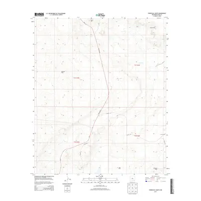
2013 Map of Tower Hill South
USGS Topo · Published 2013About this map
The arid landscape of Eddy County is defined here by the industrial infrastructure supporting the region's potash extraction. Potash Mine Rd serves as a primary north-south artery, cutting through the high desert terrain to connect remote worksites. Topographic variations are marked by distinctive local landmarks such as Tower Hill and Maroon Cliffs, while the expansive Nash Draw and Livingston Ridge dominate the southern portion of the sheet. Evidence of early ranching and water management is visible at Crawford Ranch and Red Lake. The mapping of historical routes like the Cimarron Trl alongside contemporary county roads like Co Road 890 illustrates the evolution of movement through this corner of New Mexico.
Find a feature on this map
15 named features on this map. Tap any name to fly to it.
Don’t see what you’re looking for? This feature index may not catch every label — zoom into the map to look around manually.
Map Details
Editions of this 2013 Tower Hill South Map
This is the sole edition of this map. No revisions or reprints were ever made.
Other maps of this area

1939 · Carlsbad
USGS Topo · 1:62,500

1939 · Nash Draw
USGS Topo · 1:62,500

1942 · Clayton Basin
USGS Topo · 1:62,500

1943 · Carlsbad
USGS Topo · 1:62,500

1943 · Clayton Basin
USGS Topo · 1:62,500

1943 · Oil City
USGS Topo · 1:62,500

1943 · Nash Draw
USGS Topo · 1:62,500

1954 · Carlsbad
USGS Topo · 1:250,000

1954 · Hobbs
USGS Topo · 1:250,000

1958 · Carlsbad
USGS Topo · 1:250,000