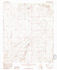
1985 Map of Tower Hill South
USGS Topo · Published 1986About this map
Industrial potash mining defines the landscape of this New Mexico map, centered on the significant operations of the Mississippi Chemical Corp Potash Mine. The terrain is characterized by dramatic escarpments and dry drainage basins, most notably the Quahada Ridge and Livingston Ridge, which frame the low-lying Nash Draw. The presence of a Tailings Pond and Disposal Pond near the mining facilities illustrates the environmental footprint of the potash industry during the late 1970s and early 1980s. To the north, the Maroon Cliffs provide a sharp topographical boundary, while smaller features like Red Lake and Tower Hill serve as local landmarks. This survey captures a moment of intense resource extraction in the Permian Basin before modern reclamation efforts altered the surface visibility of these mining footprints.
Find a feature on this map
14 named features on this map. Tap any name to fly to it.
Don’t see what you’re looking for? This feature index may not catch every label — zoom into the map to look around manually.
Map Details
Editions of this 1985 Tower Hill South Map
This is the sole edition of this map. No revisions or reprints were ever made.
Other maps of this area

1939 · Carlsbad
USGS Topo · 1:62,500

1939 · Nash Draw
USGS Topo · 1:62,500

1942 · Clayton Basin
USGS Topo · 1:62,500

1943 · Carlsbad
USGS Topo · 1:62,500

1943 · Clayton Basin
USGS Topo · 1:62,500

1943 · Oil City
USGS Topo · 1:62,500

1943 · Nash Draw
USGS Topo · 1:62,500

1954 · Carlsbad
USGS Topo · 1:250,000

1954 · Hobbs
USGS Topo · 1:250,000

1958 · Carlsbad
USGS Topo · 1:250,000