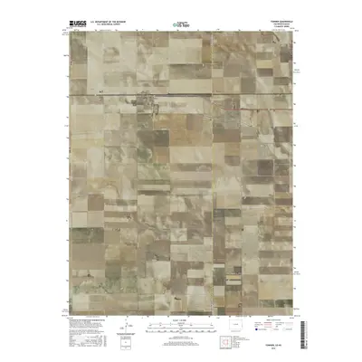
2016 Map of Towner
USGS Topo · Published 2016About this map
Towner sits at a critical intersection of state lines and county boundaries in the high plains of eastern Colorado. This 2016 survey reveals a landscape meticulously organized by the Public Land Survey System, where a rigid grid of rural roads like Co RD 70 and Co RD 78 defines the agricultural parcels. The map prominently features the Colorado Kansas border, reflecting the area's geographic identity as a gateway between the two states. Near the town center, the Towner Cem serves as a significant landmark for genealogical research, while the proximity of Kanco just across the line in Kansas underscores the cross-border connectivity of these prairie communities. The terrain is characterized by subtle elevation changes and the organized development of local infrastructure, including a network of numbered routes such as Co RD 1 and Co RD P that facilitate movement through this expansive borderland region.
Find a feature on this map
31 named features on this map. Tap any name to fly to it.
Don’t see what you’re looking for? This feature index may not catch every label — zoom into the map to look around manually.
Map Details
Editions of this 2016 Towner Map
This is the sole edition of this map. No revisions or reprints were ever made.
Other maps of this area

1890 · Granada
USGS Topo · 1:125,000

1892 · Cheyenne Wells
USGS Topo · 1:125,000

1892 · Granada
USGS Topo · 1:125,000

1894 · Cheyenne Wells
USGS Topo · 1:125,000

1894 · Granada
USGS Topo · 1:125,000

1954 · Lamar
USGS Topo · 1:250,000

1955 · Scott City
USGS Topo · 1:250,000

1958 · Lamar
USGS Topo · 1:250,000

1958 · Scott City
USGS Topo · 1:250,000

1968 · Stuart
USGS Topo · 1:24,000