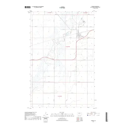
2017 Map of Towner
USGS Topo · Published 2017About this map
Towner serves as a central hub in McHenry County, where the meandering course of the Souris River dictates the surrounding topography and land use. The river winds extensively through the landscape, creating a complex network of wetlands and oxbows that dominate the central and western sections of the area. This rural landscape is defined by the rigid grid of the Public Land Survey System, with roads like 66th St NE and 9th Ave NE marking the section lines. The presence of the Towner Municipal Airport north of the town center, along with the concentration of street names such as Main St N and Airport Rd, illustrates the localized development and infrastructure supporting this prairie community. The intersection of natural watercourses and human engineering is evident in the way local routes like Follman Rd navigate the river's bend.
Find a feature on this map
29 named features on this map. Tap any name to fly to it.
Don’t see what you’re looking for? This feature index may not catch every label — zoom into the map to look around manually.
Map Details
Editions of this 2017 Towner Map
This is the sole edition of this map. No revisions or reprints were ever made.
Other maps of this area

1949 · Denbigh
USGS Topo · 1:24,000

1949 · Bantry
USGS Topo · 1:24,000

1950 · Karlsruhe NE
USGS Topo · 1:24,000

1950 · Towner NW
USGS Topo · 1:24,000

1950 · Towner
USGS Topo · 1:24,000

1950 · Denbigh
USGS Topo · 1:24,000

1950 · Bantry
USGS Topo · 1:24,000

1954 · Towner NE
USGS Topo · 1:24,000

1954 · Towner SE
USGS Topo · 1:24,000

1954 · Minot
USGS Topo · 1:250,000