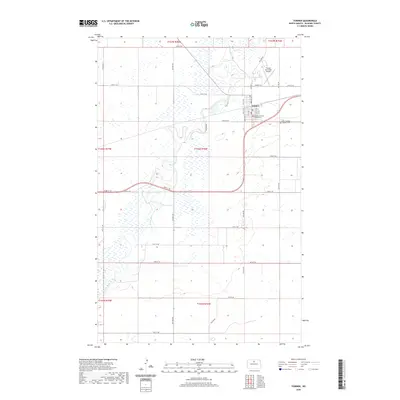
2020 Map of Towner
USGS Topo · Published 2020About this map
Towner serves as the seat of McHenry County, its town grid established just north of the meandering Souris River. The river dominates the central and western portions of this landscape, its oxbows and wetlands creating a complex hydrologic pattern through the prairie. Near the center of the settlement, the McHenry County Courthouse stands as a civic anchor, while the eastern edge of the community is marked by Saint Cecilias Catholic Cem. The surrounding terrain is largely defined by a systematic grid of section roads, such as Follman Rd and 62nd St NE, which navigate the frequent marshes and river bends. Transport and infrastructure for the region are supported by the Towner Municipal Airport north of the main residential area, reflecting the modern utility of this North Dakota agricultural hub.
Find a feature on this map
36 named features on this map. Tap any name to fly to it.
Don’t see what you’re looking for? This feature index may not catch every label — zoom into the map to look around manually.
Map Details
Editions of this 2020 Towner Map
This is the sole edition of this map. No revisions or reprints were ever made.
Other maps of this area

1949 · Denbigh
USGS Topo · 1:24,000

1949 · Bantry
USGS Topo · 1:24,000

1950 · Karlsruhe NE
USGS Topo · 1:24,000

1950 · Towner NW
USGS Topo · 1:24,000

1950 · Towner
USGS Topo · 1:24,000

1950 · Denbigh
USGS Topo · 1:24,000

1950 · Bantry
USGS Topo · 1:24,000

1954 · Towner NE
USGS Topo · 1:24,000

1954 · Towner SE
USGS Topo · 1:24,000

1954 · Minot
USGS Topo · 1:250,000