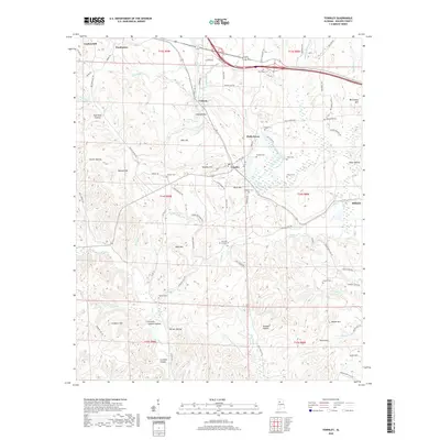
2020 Map of Townley
USGS Topo · Published 2020About this map
The settlement of Townley and its surrounding hills dominate this Walker County landscape, where the headwaters of several drainages meet. The terrain is defined by a dense network of named hollows and hills, such as Gum Suck Hollow, Guthrie Hollow, and Lockhart Hill, reflecting a long history of local naming conventions tied to families and early settlers. A remarkable concentration of small family and community burial grounds is scattered across the topography, including Fike and Inman Cem, Kings Cem, and Lawson Cem. These sites, often positioned on high ground near watercourses like Horse Cr and Lost Creek, offer significant points of interest for genealogists tracing regional lineages. The survey also captures the relationship between small hamlets like Holly Grove and Cedrum and the local road systems, including the notably named Copperhead Rd and Coal Valley RD.
Find a feature on this map
101 named features on this map. Tap any name to fly to it.
Don’t see what you’re looking for? This feature index may not catch every label — zoom into the map to look around manually.
Map Details
Editions of this 2020 Townley Map
This is the sole edition of this map. No revisions or reprints were ever made.
Other maps of this area

1893 · Jasper
USGS Topo · 1:125,000

1949 · Parrish
USGS Topo · 1:24,000

1949 · Townley
USGS Topo · 1:24,000

1949 · Jasper
USGS Topo · 1:24,000

1949 · Oakman
USGS Topo · 1:24,000

1949 · Manchester
USGS Topo · 1:24,000

1949 · Nauvoo
USGS Topo · 1:24,000

1950 · Nauvoo
USGS Topo · 1:24,000

1950 · Manchester
USGS Topo · 1:24,000

1951 · Jasper
USGS Topo · 1:24,000