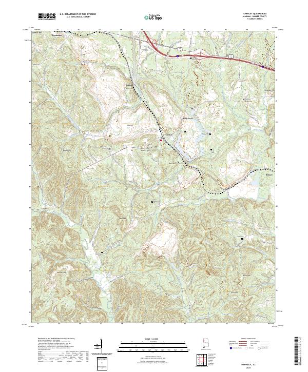
2024 Map of Townley
USGS Topo · Published 2024About this map
Townley and Holly Grove anchor this portion of Walker County, where the industrial legacy of the Alabama coalfields meets the intricate drainage of the Lost Creek basin. The landscape is defined by a dense network of family-named hollows and ridges, such as Lockhart Hollow and Wolf Mtn, reflecting generations of local settlement. The BNSF Railway corridor parallels the modern highway system, tracing the historical movement of resources through the region. Genealogists will find a high concentration of burial sites, including the Old New Hope Cem, Mackey Boshell Cem, and Guthrie Cem, many situated on high ground overlooking tributaries like Hurricane Creek and Wolf Creek. The survey captures the modern road network, including Coal Valley Rd, while preserving the names of traditional landmarks like Preston Guthrie Hollow.
Find a feature on this map
105 named features on this map. Tap any name to fly to it.
Don’t see what you’re looking for? This feature index may not catch every label — zoom into the map to look around manually.
Map Details
Editions of this 2024 Townley Map
This is the sole edition of this map. No revisions or reprints were ever made.
Other maps of this area

1893 · Jasper
USGS Topo · 1:125,000

1949 · Parrish
USGS Topo · 1:24,000

1949 · Townley
USGS Topo · 1:24,000

1949 · Jasper
USGS Topo · 1:24,000

1949 · Oakman
USGS Topo · 1:24,000

1949 · Manchester
USGS Topo · 1:24,000

1949 · Nauvoo
USGS Topo · 1:24,000

1950 · Nauvoo
USGS Topo · 1:24,000

1950 · Manchester
USGS Topo · 1:24,000

1951 · Jasper
USGS Topo · 1:24,000