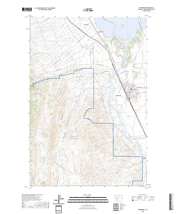
2024 Map of Townsend
USGS Topo · Published 2024About this map
The Missouri River winds through the heart of Broadwater County in this recent survey, defining the valley floor where the county seat of Townsend serves as a regional hub. The town's grid is anchored by the Broadwater County Courthouse and the local Po, while the surrounding landscape is a complex mix of agricultural land and military activity. To the west, the NG MTA Limestone Hills cover the high ground of the Limestone Hills and Little Hogback, establishing a significant military presence in the area. Water management remains central to the region's character, evidenced by Canyon Ferry Lake to the north and the Irish Ditch and Indian Creek that traverse the valley. Local history is preserved at the Centerville Cem and the settlement of Bedford, marking decades of habitation along the river corridor.
Find a feature on this map
62 named features on this map. Tap any name to fly to it.
Don’t see what you’re looking for? This feature index may not catch every label — zoom into the map to look around manually.
Map Details
Editions of this 2024 Townsend Map
This is the sole edition of this map. No revisions or reprints were ever made.
Other maps of this area

1886 · Fort Logan
USGS Topo · 1:250,000

1948 · White Sulphur Springs
USGS Topo · 1:250,000

1949 · Radersburg
USGS Topo · 1:62,500

1949 · Toston
USGS Topo · 1:62,500

1950 · Townsend
USGS Topo · 1:62,500

1950 · Duck Creek Pass
USGS Topo · 1:62,500

1958 · White Sulphur Springs
USGS Topo · 1:250,000

1961 · White Sulphur Springs
USGS Topo · 1:250,000

1965 · White Sulphur Springs
USGS Topo · 1:250,000

1976 · Townsend
USGS Topo · 1:100,000