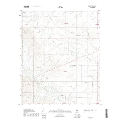
2018 Map of Townsend
USGS Topo · Published 2018About this map
The Sucarnoochee River flows through the southern reaches of this Kemper County landscape, creating a complex drainage network where Straight Cr and Snoody Cr meet the main channel. The settlement of Townsend and the nearby locale of Carters serve as the primary human focal points, situated north of Sucarnoochee Hill. For those tracing local families, the map identifies several burial grounds including Antioch Cem, Cherry Cem, and Felton Cem, which are linked by a web of rural roads such as Old Dekalb Scooba Rd and Joe Persons Rd. The terrain is defined by numerous creek branches, including Big Scooba Cr, Flat Scooba Cr, and Little Scooba Cr, illustrating the well-watered nature of this timber and agricultural region. Extensive roads managed by the local timber industry, including several segments of Weyerhaeuser Rd, crisscross the area between Hoppers Lake and the river valley.
Find a feature on this map
46 named features on this map. Tap any name to fly to it.
Don’t see what you’re looking for? This feature index may not catch every label — zoom into the map to look around manually.
Map Details
Editions of this 2018 Townsend Map
This is the sole edition of this map. No revisions or reprints were ever made.
Other maps of this area

1953 · Meridian
USGS Topo · 1:250,000

1957 · Meridian
USGS Topo · 1:250,000

1962 · Lauderdale NW
USGS Topo · 1:24,000

1962 · Oak Grove
USGS Topo · 1:24,000

1962 · Shuqualak
USGS Topo · 1:24,000

1963 · De Kalb
USGS Topo · 1:24,000

1963 · Townsend
USGS Topo · 1:24,000

1963 · Gholson
USGS Topo · 1:24,000

1965 · Meridian
USGS Topo · 1:250,000

1973 · Scooba
USGS Topo · 1:24,000