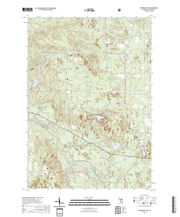
2023 Map of Townsend Lake
USGS Topo · Published 2023About this map
The Pere Marquette Wild and Scenic River carves a winding path through this corner of the Manistee National Forest, a landscape defined by its dense network of glacial lakes and northern woodlands. The terrain rises toward the Ward Hills in the northwest, while the southern reaches are punctuated by small water bodies like Baumann Lake and Wingleton Lake. Local history is anchored by the presence of Sweetwater Cem near the upper reaches of Sweetwater Creek and Evergreen Cem further south. This modern survey illustrates the enduring relationship between the region's protected forest lands and the intricate hydrology of Kinney Creek and Loon Creek, which feed into the larger river system and support the area's recreational and environmental heritage.
Find a feature on this map
64 named features on this map. Tap any name to fly to it.
Don’t see what you’re looking for? This feature index may not catch every label — zoom into the map to look around manually.
Map Details
Editions of this 2023 Townsend Lake Map
This is the sole edition of this map. No revisions or reprints were ever made.
Other maps of this area

1931 · Baldwin NW
USGS Topo · 1:31,680

1931 · Custer NE
USGS Topo · 1:31,680

1931 · Baldwin NE
USGS Topo · 1:31,680

1931 · Custer SE
USGS Topo · 1:31,680

1932 · Freesoil SE
USGS Topo · 1:31,680

1933 · Peacock SE
USGS Topo · 1:31,680

1933 · Peacock SW
USGS Topo · 1:31,680

1954 · Traverse City
USGS Topo · 1:250,000

1954 · Milwaukee
USGS Topo · 1:250,000

1954 · Midland
USGS Topo · 1:250,000
Featured Places
- Lake Township, MI
- Webber Township, MI
- Pleasant Plains Township, MI
- Sauble Township, MI
- Sweetwater Township, MI