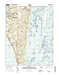
2016 Map of Townsend
USGS Topo · Published 2016About this map
Arlington and the southern tip of Virginia's Eastern Shore appear in this survey of Northampton County, where the peninsula tapers between the Chesapeake Bay and the Atlantic Ocean. The landscape is a network of coastal settlements and agricultural heritage, shown through locations like Townsend, Capeville, and Cheapside. Near the western shore, Butlers Bluff and Kiptopeke Beach overlook the bay, while the eastern side is dominated by a complex of tidal marshes and barrier islands including Mockhorn Island and Smith Island. A notable historical presence is found along Custis Tomb Rd, reflecting the deep-rooted colonial lineage of the region. The map also captures the local reliance on small-scale aviation with the Bull Farm Airport and Scott Farm Strip, alongside the critical water corridor of the Intracoastal Waterway cutting through Magothy Bay.
Find a feature on this map
101 named features on this map. Tap any name to fly to it.
Don’t see what you’re looking for? This feature index may not catch every label — zoom into the map to look around manually.
Map Details
Editions of this 2016 Townsend Map
This is the sole edition of this map. No revisions or reprints were ever made.
Other maps of this area

1942 · Cheriton
USGS Topo · 1:24,000

1942 · Cobb Island
USGS Topo · 1:24,000

1943 · Elliots Creek
USGS Topo · 1:25,000

1943 · Townsend
USGS Topo · 1:24,000

1943 · Richmond
USGS Topo · 1:250,000

1946 · Eastville
USGS Topo · 1:250,000

1948 · Cape Charles
USGS Topo · 1:24,000

1949 · Richmond
USGS Topo · 1:250,000
1953 · Ship Shoal Inlet
USGS Topo · 1:24,000
1955 · Elliotts Creek
USGS Topo · 1:24,000