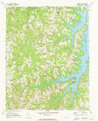
1970 Map of Townsville
USGS Topo · Published 1973About this map
Williamsboro and Townsville anchor this 1970 study of Vance County, captured as the local landscape adapted to the presence of the John H Kerr Reservoir. The eastern edge of the map is dominated by the reservoir’s many-fingered shoreline, including the Townsville Landing and the Nutbush Bridge Campground. Further inland, the terrain is defined by a dense network of country churches and family-named crossroads, such as Hicks Crossroads and Harris Crossroads.
Find a feature on this map
37 named features on this map. Tap any name to fly to it.
Don’t see what you’re looking for? This feature index may not catch every label — zoom into the map to look around manually.
Map Details
Editions of this 1970 Townsville Map
2 editions found
Other maps of this area

1941 · Clarksville
USGS Topo · 1:48,000

1943 · Clarksville
USGS Topo · 1:62,500

1953 · Oxford
USGS Topo · 1:62,500

1953 · Greensboro
USGS Topo · 1:250,000

1954 · Greensboro
USGS Topo · 1:250,000

1955 · Boydton
USGS Topo · 1:62,500

1957 · Clarksville
USGS Topo · 1:62,500

1962 · Greensboro
USGS Topo · 1:250,000

1966 · Greensboro
USGS Topo · 1:250,000

1966 · Oxford
USGS Topo · 1:62,500