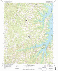
1970 Map of Townsville
USGS Topo · Published 1973About this map
Townsville and Williamsboro serve as the primary anchors for this rural landscape in the early 1970s, an area defined by the massive footprint of the John H Kerr Reservoir. The map captures a moment when the regional hydrology had been permanently altered by the reservoir's inundation, yet the old overland network remains visible through features like the Old RR Grade. Small rural hubs such as Knotts Crossroads, Kellys Crossroads, and Hicks Crossroads dot the terrain, reflecting a settlement pattern built around traditional junctions.
Find a feature on this map
34 named features on this map. Tap any name to fly to it.
Don’t see what you’re looking for? This feature index may not catch every label — zoom into the map to look around manually.
Map Details
Editions of this 1970 Townsville Map
2 editions found
Other maps of this area

1941 · Clarksville
USGS Topo · 1:48,000

1943 · Clarksville
USGS Topo · 1:62,500

1953 · Oxford
USGS Topo · 1:62,500

1953 · Greensboro
USGS Topo · 1:250,000

1954 · Greensboro
USGS Topo · 1:250,000

1955 · Boydton
USGS Topo · 1:62,500

1957 · Clarksville
USGS Topo · 1:62,500

1962 · Greensboro
USGS Topo · 1:250,000

1966 · Greensboro
USGS Topo · 1:250,000

1966 · Oxford
USGS Topo · 1:62,500