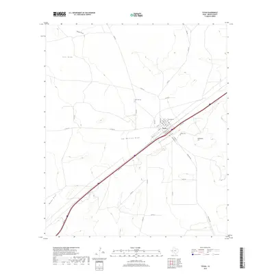
2019 Map of Toyah
USGS Topo · Published 2019About this map
The town of Toyah occupies a centralized position in Reeves County, serving as a hub for local transit and history. The grid-like layout of the settlement is defined by streets such as Stocking St and S Front St, while the surrounding landscape is carved by several significant ephemeral watercourses, including San Martine Draw, Billingslea Draw, and Salt Draw. These draws are critical drainage features in this arid environment, illustrating the hydrological patterns of the Trans-Pecos region.
Find a feature on this map
37 named features on this map. Tap any name to fly to it.
Don’t see what you’re looking for? This feature index may not catch every label — zoom into the map to look around manually.
Map Details
Editions of this 2019 Toyah Map
This is the sole edition of this map. No revisions or reprints were ever made.
Other maps of this area

1921 · Toyah
USGS Topo · 1:125,000

1954 · Pecos
USGS Topo · 1:250,000

1955 · Saragosa
USGS Topo · 1:62,500

1957 · Pecos
USGS Topo · 1:250,000

1970 · Hermosa SW
USGS Topo · 1:24,000

1970 · Florenzo Hill
USGS Topo · 1:24,000

1970 · Big Hill
USGS Topo · 1:24,000

1970 · Toyah
USGS Topo · 1:24,000
1970 · Hermosa
USGS Topo · 1:24,000
1970 · Gozar
USGS Topo · 1:24,000